
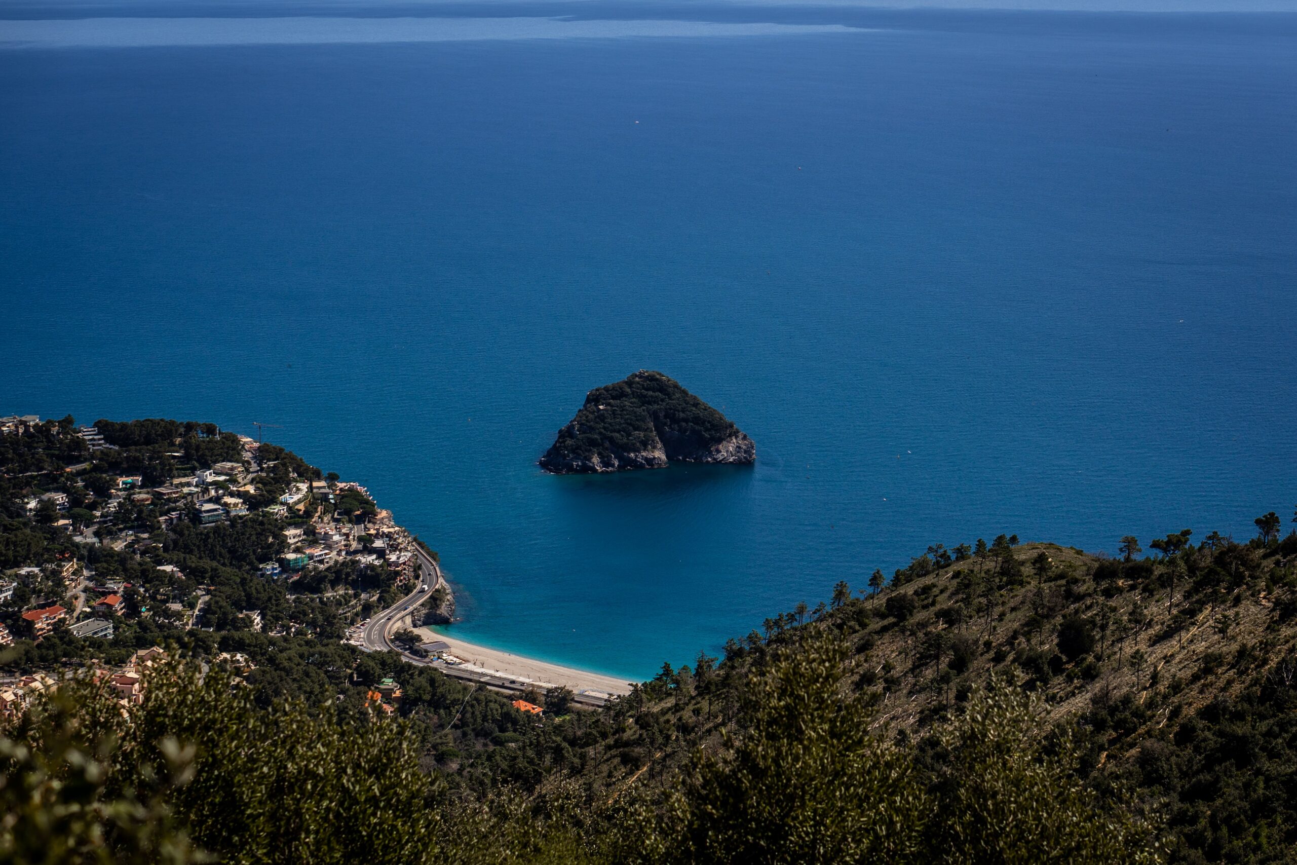
Monte Mao: first-rate panoramic view of theBergeggi Island Marine Protected Area
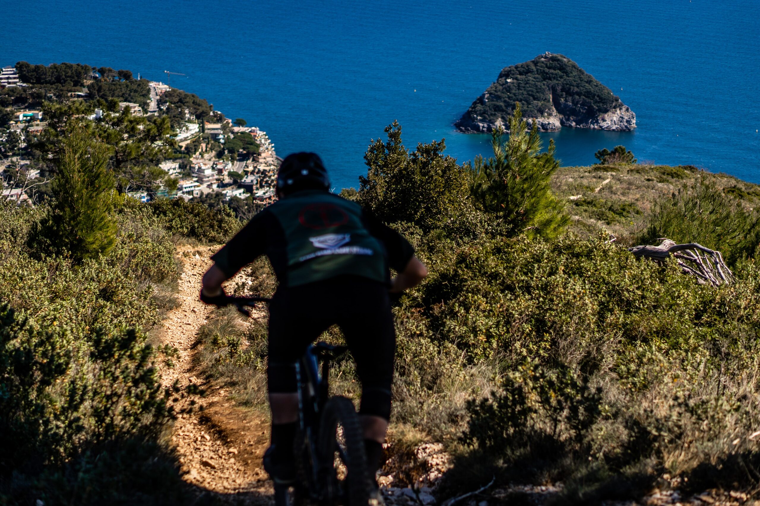
Today we present a route that will offer you an incredible view over the whole Savonese area, perfect to travel both by bike and on foot! The route in fact develops in a ring on the heights of Spotorno, along the ancient Via Julia Augusta and on a natural "balcony" that offers wide panoramic views of the Ligurian coast.
Mount Mao, with its 434 meters above sea level, offers a privileged point of view on the Gulf of the Island. Let's see how to achieve it!
Source: “Munta and Chinn'a” - Franco Leonuro
Technical notes
Departure and arrival: Cough, fraction of Noli (SV)
Difference: About 410m
Length: about 12 km
Total travel time: 4h, 30
Signpost: Outward: up to Colle del Trevo no signpost-From here to Monte Mao "yellow-red and TA" signs
Return: up to Colle della Berba "yellow-red TA" signpost (TerreAlte).
Outward itinerary
To reach Monte Mao we take the inter-municipal asphalted road to Vado Ligure (ancient via Julia Augusta), which initially winds along the slopes of the Bric Berba. After about 1km, after passing a tank of the aqueduct, you will find a bifurcation.
We continue until we reach the locality "Masca Bruciata", on the heights of Spotorno. With a further walk, one arrives in the locality of “Metti”, where an itinerary coming from Spotorno meets (signposted “red rhombus”).
Continuing on, you pass by the “Case del Trevo”, pass the deviation to the left at a bend that goes up to Bric Colombino and you reach the widening of Colle del Trevo amidst sweeping views of the coast.
At this point we continue straight ahead to tackle a steep climb from the cemented bottom that leads to the Colletto di Passo Stretto.
Here, on the right, there is a steep ramp that soon leads to the summit of Mount Mao.
Return route
To return to the coast we follow the uphill path backwards to the area of the Trevo houses. Just beyond these, on the right, we take an uphill road that leads with various bends on the top of the Bric Colombino, characterized by various antennas and repeaters.
We continue on the panoramic and evident ridge track until we meet a dirt road on the right.
Here we are presented with two possibilities:
- continue on the ridge which, with a long but panoramic route (about 1,5km), in which steep ups and downs alternate, arrive at the crossroads of Colle della Berba;
- take the dirt road that proceeds just below that of the ridge and which, with a similar long route, flatter and less panoramic, joins the previous one at Colle della Berba.
Here we leave the main road, to turn left onto a track, which after a short downhill stretch becomes asphalted, and ends by taking the road of the outward journey.
Fans of trekking or mountain biking: you just have to try this route!
Photo: Spotorno Outdoor


